| Find Louisiana State Museum on Facebook |
 | Find Louisiana State Museum on Twitter |
| 2016 Sunset Report |
| OLG & DCRT Strategic Plan 2020-21 through 2024-25 |

- Quality - Louisiana State Library
85% of the users of the State Library indicated that the State Library's services and resources was a good value for the State.Source: The Impact of the Louisiana Department of Culture, Recreation and Tourism on Louisiana's Economy and Quality of Life for Louisiana's Citizens - June 2006
- Louisiana's deep water ports
Did you know that Louisiana's five deep water ports handle more than 457 million tons of U.S. waterborne commerce a year? - Quality - Louisiana State Library
85% of the users of the State Library indicated that the State Library's services and resources was a good value for the State.Source: The Impact of the Louisiana Department of Culture, Recreation and Tourism on Louisiana's Economy and Quality of Life for Louisiana's Citizens - June 2006
- Atchafalaya Heritage Area
The Atchafalaya Heritage Area has been designated by Congress as a National Heritage Area.
- Impact - DCRT Returns Investment Dollars to Louisiana
For every state tax dollar spent by the Department of Culture, Recreation and Tourism, $5.86 is returned to the State Treasury and citizens of Louisiana.Source: The Impact of the Louisiana Department of Culture, Recreation and Tourism on Louisiana's Economy and Quality of Life for Louisiana's Citizens - June 2006
- Impact - Louisiana Office of Tourism Tops Returns on Investment
$13.90 is the return on investment for every dollar spent by the Office of Tourism. Over 175,000 people were directly employed by the Louisiana travel and tourism industry in 2004. In terms of production, $5.9 billion (3.8%) of Louisiana's Gross State Product was directly attributable to expenditures by visitors to LouisianaSource: The Impact of the Louisiana Department of Culture, Recreation and Tourism on Louisiana's Economy and Quality of Life for Louisiana's Citizens - June 2006
- Impact - Supporting the Louisiana Arts
Every dollar in state support for the Arts leverages $7 in earned and contributed revenue. Louisiana's cultural enterprises provide nearly 144,000 jobs for Louisiana citizens, accounting for 7.6% of total employment. Arts has a total economic impact of $934 million in Louisiana.Source: The Impact of the Louisiana Department of Culture, Recreation and Tourism on Louisiana's Economy and Quality of Life for Louisiana's Citizens - June 2006
- Impact - Visitors Generate State Revenue
In terms of tax revenues, visitor spending accounted for $677 million of 2004 Louisiana revenues, or 8.3% of the total 2004 State Budget.Source: The Impact of the Louisiana Department of Culture, Recreation and Tourism on Louisiana's Economy and Quality of Life for Louisiana's Citizens - June 2006
- Quality - Louisiana State Museums
95% of State Museum's visitors strongly agreed or agreed that the State Museum was an educational experience and has expanded their awareness of Louisiana's cultural history.Source: The Impact of the Louisiana Department of Culture, Recreation and Tourism on Louisiana's Economy and Quality of Life for Louisiana's Citizens - June 2006
- Quality - Historic Preservation and the Arts
78-80% of Louisiana residents believe that historic preservation and arts are important and should be high priorities.Source: The Impact of the Louisiana Department of Culture, Recreation and Tourism on Louisiana's Economy and Quality of Life for Louisiana's Citizens - June 2006
- Impact - Louisiana Serve Program
The Louisiana Serve Program in the Office of Lieutenant Governor returns 2.8 million in non-state revenue to Louisiana. - Impact - Louisiana State Museum
The Office of State Museum returns $6.99 for every tax dollar spent.Source: The Impact of the Louisiana Department of Culture, Recreation and Tourism on Louisiana's Economy and Quality of Life for Louisiana's Citizens - June 2006
- Impact - Louisiana State Parks
Visitor spending at Louisiana State Parks returns $3.23 in state taxes for every dollar spend on operating and maintaining all our beautiful parks. Out-of-state visitors to Louisiana State Parks spent almost $12 million in Louisiana and produced an economic impact of over $24 million. Louisiana residents spent another $29.2 million while visiting the parks.Source: The Impact of the Louisiana Department of Culture, Recreation and Tourism on Louisiana's Economy and Quality of Life for Louisiana's Citizens - June 2006
- Impact - Scenic Byways Program
The Scenic Byways program leverages $1.56 for every dollar spent by the program.Source: The Impact of the Louisiana Department of Culture, Recreation and Tourism on Louisiana's Economy and Quality of Life for Louisiana's Citizens - June 2006
- Louisiana State Parks and the National Register
Thirteen Louisiana State Parks sites are on the National Register of Historic Places. They include:
• Audubon State Historic Site
• Centenary State Historic Site
• Fort Pike State Historic Site
• Fort Jesup State Historic Site
• Longfellow-Evangeline State Historic Site
• Mansfield State Historic Site
• Marksville State Historic Site
• Plaquemine Lock State Historic Site
• Port Hudson State Historic Site
• Poverty Point State Historic Site
• Otis House at Fairview-Riverside State Park
• Rosedown Plantation State Historic Site
• Winter Quarters State Historic Site - Louisiana State Parks Visitation
Nearly two million people visited a Louisiana State Park last year. - Louisiana State Parks Grow and Renew
The Louisiana Office of State Parks has spent nearly $80 million in major construction projects since 2004, providing two brand-new parks and a new historic site, adding cabins and campsites to existing parks and building visitor center at one park, the preservation area and three historic sites. - Louisiana State Parks Wireless Internet
The Louisiana Office of State Parks provides free wireless internet access at all 20 recreational parks. Extensive coverage areas include most cabins, RV slips and campsites. - Louisiana State Parks Online Reservations
You can now make online reservations for cabins, campsites, lodges and group camps – at www.ReserveLaStateParks.com - Louisiana State Parks Honors National Parks Service Senior Pass Program
Visitors who hold an America the Beautiful Senior or Access Pass, and whose home State Park system honor the America the Beautiful passes for camping discounts, are entitled to a 50% reduction on camping fees at Louisiana State Parks. Certain restrictions apply, see State Parks' fees & facilities page for more information. - Louisiana State Parks Draw Media Attention
Louisiana State Parks sites have been featured in movie and television releases including "True Detective," CBS’ "Zoo," and "NCIS: New Orleans," "G.I. Joe: Retaliation," "Selfless," "Devil’s Due," and commercials for Popeyes and Toyota. - Capitol Park Welcome Center
The main meeting room in the Capitol Park Welcome Center is named after Margaret Taylor, wife of U.S. President Zachary Taylor. The couple resided in a small house near the present day location of Capitol Park until Taylor was elected to the Presidency.
The purchase added to the United States a region very different from others on the American map. Louisiana had a more ethnically and racially diverse population than many parts of the United States, and its political and social systems were deeply rooted in the French and Spanish colonial period. Although American procedures eventually replaced many of those of the colonial era, Americans did not mold Louisiana into a state like all others. The United States government made Louisiana residents go through a trial period before admitting Louisiana as a state. However, many of Louisiana's unique aspects, rooted in the colonial period, remain intact today.
Exploration
The Louisiana Purchase treaty did not define where the exact boundaries of the new territory were. The only boundaries the French recognized were those existing when Spain gave them the colony, and these were very uncertain. Louisiana was a huge land mass, and no one knew for sure just how far it reached. This opened the door for new exploration and settlement.
In order to claim its new territory with authority, the United States first had to explore and then populate it. President Jefferson commissioned Meriwether Lewis and William Clark to head the first transcontinental expedition. In May 1804, once the transfer of Louisiana to the United States was official, Lewis and Clark departed from the St. Louis area with some forty enlisted soldiers. Their journey up the Missouri River, into uncharted lands, across the Great Divide, and along the Columbia River to the Pacific Ocean took over a year. They returned to St. Louis in September 1806.
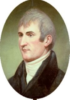 | Meriwether Lewis C. W. Peale 1807 President Jefferson appointed Lewis as governor of Upper Louisiana after the success of his transcontinental expedition with William Clark. Reproduced courtesy of Independence National Historical Park |
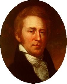 | William Clark C. W. Peale 1810 Clark was appointed head of Indian affairs of Upper Louisiana as a result of his exploration of the Louisiana territory with Meriwether Lewis. Reproduced courtesy of Independence National Historic Park |
The Lewis and Clark expedition was the first government-sponsored scientific enterprise in the United States. It was America's first attempt to evaluate the environment of the Great Plains, the breadth of the Rockies, and the nature and extent of the terrain west of the Continental Divide. Geographical discoveries made by Lewis and Clark and recorded in their journals vastly expanded American knowledge of the new territory and helped promote trade and settlement in the region.
Other explorers, including Zebulon Pike, William Dunbar, and George Hunter explored other important river regions in the new Louisiana territory to add to Lewis's and Clark's discoveries.
Piracy and Smuggling
Long a feature of Louisiana life, piracy, smuggling, and other illicit economic activities became even more pronounced during the territorial period and undermined United States authority in the region. In flagrant violation of United States laws, traders of all nationalities smuggled slaves and goods into Louisiana through the numerous swamps, bayous, and rivers that were too difficult to police.
Among the most infamous pirates were brothers Jean and Pierre Laffite and Renato Beluche. These men led groups of French and Spanish pirates who were given official status by the United States since they represented American interests by attacking enemy ships and capturing their goods. These pirates were known as privateers. The Laffite privateers, along with their white, free black, and runaway slave accomplices, ran goods into Louisiana, primarily through Barataria Bay below New Orleans. The Laffites also engaged in legitimate trade.
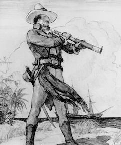 | Jean Lafitte Newell Convers Wyeth c. 1910 This dramatic pencil drawing indicates the romantic nature of pirate legend as seen by the artist and illustrator N. C. Wyeth, father of famous American artist Andrew Wyeth. Gift of John Morrell and Co. |
Border Conflicts
Spain and the United States could not agree on Louisiana's western border with Texas, which was then still held by Mexico. Spanish officials maintained that the Texan border traditionally had extended to the Arroyo Hondo, a dry gulch west of Natchitoches. The United States, however, argued that Louisiana's border stretched at least to the Sabine River, and possibly even to the Rio Grande.
Negotiations to resolve the western border dispute broke down when Spain and the United States severed diplomatic relations in 1805. Rumors circulated that both sides were gathering troops near the contested area, and in 1806 General Wilkinson sent his forces up the Red River. However, General Wilkinson managed to avert warfare and found a solution acceptable to both sides, in part because he served both parties--the United States as commander of southwestern troops and Spain as a spy. The compromise that was reached with Spain established a "neutral strip" in the disputed area, with neither power presiding over it for over a decade. Finally, in 1819 a treaty signed by both parties placed the boundary between Texas and the United States along the Sabine River, where it remains today.
Territorial Law and Government
Closing the vast chasm that separated Anglo-American and European colonial political traditions posed the greatest challenge to Claiborne's leadership. The various European ethnic groups already in Louisiana, primarily those of French and Spanish descent (commonly known as creoles), united to resist United States imposition of Anglo-American political and cultural systems. During this time, Louisiana served as a laboratory in which United States officials experimented with various methods for establishing control of lands previously held by other nations.
Two political organizational units unique to Louisiana were implemented during this experimental period: the parish system and the police jury system. In 1807 the territorial legislature replaced the twelve counties created shortly after the Louisiana Purchase with nineteen civil parishes. They were modeled on the Catholic parishes that existed during French and Spanish rule. The parish, rather than the county, still constitutes the basic unit of local government in Louisiana.
Under the parish system, the parish judge, justices of the peace, and a group of twelve citizens carried out administrative duties on a local level. This twelve-person body came to be known as the police jury. The police jury system, modeled after the Spanish system of syndics, was roughly equivalent to most states' county court systems.
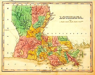 | Map of Louisiana Anthony Finley 1829 This map shows the parishes of Louisiana. Gift of the Friends of the Cabildo |
Territorial officials had to merge English common law, familiar to most Americans, with French and Spanish civil law procedures long practiced in Louisiana. Common law placed greater reliance on the judiciary as the source of new law, whereas civil law looked to other agencies and placed more emphasis on weighing the interests of various groups than on protecting the rights of individuals. A partial remedy to the legal mayhem was the Civil Code of 1808, which drew upon French and Spanish colonial law and the Napoleonic Code. Its drafters represented both Anglo-American and European factions, and it instituted some unique aspects of Louisiana law.
In 1811 the United States Congress authorized the calling of a state convention to draw up a constitution for Louisiana. According to the 1810 census, more than 76,000 people, about half black and half white, resided in the Territory of Orleans, which constituted the present state of Louisiana, minus the parishes east of the Mississippi River. This number exceeded the minimum population of 60,000 specified for statehood. The convention of forty-three delegates, half Anglo and half of French descent, deliberated in a New Orleans coffeehouse, presided over by prominent planter and politician Julien Poydras.
Louisiana's 1812 constitution, conservative for the time, was modeled after that of Kentucky, providing for a two-house legislature, limited suffrage, and extensive executive powers. Only adult white males who paid taxes could vote, disqualifying two-thirds of the adult white male population and all nonwhites and women. Age, property, and residency requirements restricted those who could hold office.
Unlike most states, Louisiana's governor had the authority, with senate approval, to appoint all judges and local officials. This policy of a strong head of state accorded with Louisiana's French and Spanish colonial tradition of powerful governors.
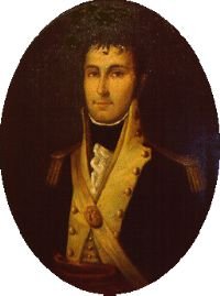 | William Charles Cole Claiborne E. B. Savary 19th century William Charles Cole Claiborne acted as first territorial governor of lower Louisiana from 1803 to 1812. A native of Virginia and friend of President Thomas Jefferson, Claiborne had previously served in Congress and as governor of the Mississippi Territory. Loaned by the Louisiana Historical Society |
On April 30, 1812, exactly nine years after the signing of the Louisiana Purchase, Congress admitted Louisiana as the eighteenth state in the Union. The convention requested that Congress add the Florida parishes to the new state, and Congress honored this request. In late June 1812, Louisianians elected William Claiborne their first state governor.