 | Find Louisiana State Museum on Facebook |
 | Find Louisiana State Museum on Twitter |
| 2016 Sunset Report |
| OLG & DCRT Strategic Plan 2020-21 through 2024-25 |

- Quality - Louisiana State Library
85% of the users of the State Library indicated that the State Library's services and resources was a good value for the State.Source: The Impact of the Louisiana Department of Culture, Recreation and Tourism on Louisiana's Economy and Quality of Life for Louisiana's Citizens - June 2006
- Louisiana's deep water ports
Did you know that Louisiana's five deep water ports handle more than 457 million tons of U.S. waterborne commerce a year? - Quality - Louisiana State Library
85% of the users of the State Library indicated that the State Library's services and resources was a good value for the State.Source: The Impact of the Louisiana Department of Culture, Recreation and Tourism on Louisiana's Economy and Quality of Life for Louisiana's Citizens - June 2006
- Atchafalaya Heritage Area
The Atchafalaya Heritage Area has been designated by Congress as a National Heritage Area.
- Impact - DCRT Returns Investment Dollars to Louisiana
For every state tax dollar spent by the Department of Culture, Recreation and Tourism, $5.86 is returned to the State Treasury and citizens of Louisiana.Source: The Impact of the Louisiana Department of Culture, Recreation and Tourism on Louisiana's Economy and Quality of Life for Louisiana's Citizens - June 2006
- Impact - Louisiana Office of Tourism Tops Returns on Investment
$13.90 is the return on investment for every dollar spent by the Office of Tourism. Over 175,000 people were directly employed by the Louisiana travel and tourism industry in 2004. In terms of production, $5.9 billion (3.8%) of Louisiana's Gross State Product was directly attributable to expenditures by visitors to LouisianaSource: The Impact of the Louisiana Department of Culture, Recreation and Tourism on Louisiana's Economy and Quality of Life for Louisiana's Citizens - June 2006
- Impact - Supporting the Louisiana Arts
Every dollar in state support for the Arts leverages $7 in earned and contributed revenue. Louisiana's cultural enterprises provide nearly 144,000 jobs for Louisiana citizens, accounting for 7.6% of total employment. Arts has a total economic impact of $934 million in Louisiana.Source: The Impact of the Louisiana Department of Culture, Recreation and Tourism on Louisiana's Economy and Quality of Life for Louisiana's Citizens - June 2006
- Impact - Visitors Generate State Revenue
In terms of tax revenues, visitor spending accounted for $677 million of 2004 Louisiana revenues, or 8.3% of the total 2004 State Budget.Source: The Impact of the Louisiana Department of Culture, Recreation and Tourism on Louisiana's Economy and Quality of Life for Louisiana's Citizens - June 2006
- Quality - Louisiana State Museums
95% of State Museum's visitors strongly agreed or agreed that the State Museum was an educational experience and has expanded their awareness of Louisiana's cultural history.Source: The Impact of the Louisiana Department of Culture, Recreation and Tourism on Louisiana's Economy and Quality of Life for Louisiana's Citizens - June 2006
- Quality - Historic Preservation and the Arts
78-80% of Louisiana residents believe that historic preservation and arts are important and should be high priorities.Source: The Impact of the Louisiana Department of Culture, Recreation and Tourism on Louisiana's Economy and Quality of Life for Louisiana's Citizens - June 2006
- Impact - Louisiana Serve Program
The Louisiana Serve Program in the Office of Lieutenant Governor returns 2.8 million in non-state revenue to Louisiana. - Impact - Louisiana State Museum
The Office of State Museum returns $6.99 for every tax dollar spent.Source: The Impact of the Louisiana Department of Culture, Recreation and Tourism on Louisiana's Economy and Quality of Life for Louisiana's Citizens - June 2006
- Impact - Louisiana State Parks
Visitor spending at Louisiana State Parks returns $3.23 in state taxes for every dollar spend on operating and maintaining all our beautiful parks. Out-of-state visitors to Louisiana State Parks spent almost $12 million in Louisiana and produced an economic impact of over $24 million. Louisiana residents spent another $29.2 million while visiting the parks.Source: The Impact of the Louisiana Department of Culture, Recreation and Tourism on Louisiana's Economy and Quality of Life for Louisiana's Citizens - June 2006
- Impact - Scenic Byways Program
The Scenic Byways program leverages $1.56 for every dollar spent by the program.Source: The Impact of the Louisiana Department of Culture, Recreation and Tourism on Louisiana's Economy and Quality of Life for Louisiana's Citizens - June 2006
- Louisiana State Parks and the National Register
Thirteen Louisiana State Parks sites are on the National Register of Historic Places. They include:
• Audubon State Historic Site
• Centenary State Historic Site
• Fort Pike State Historic Site
• Fort Jesup State Historic Site
• Longfellow-Evangeline State Historic Site
• Mansfield State Historic Site
• Marksville State Historic Site
• Plaquemine Lock State Historic Site
• Port Hudson State Historic Site
• Poverty Point State Historic Site
• Otis House at Fairview-Riverside State Park
• Rosedown Plantation State Historic Site
• Winter Quarters State Historic Site - Louisiana State Parks Visitation
Nearly two million people visited a Louisiana State Park last year. - Louisiana State Parks Grow and Renew
The Louisiana Office of State Parks has spent nearly $80 million in major construction projects since 2004, providing two brand-new parks and a new historic site, adding cabins and campsites to existing parks and building visitor center at one park, the preservation area and three historic sites. - Louisiana State Parks Wireless Internet
The Louisiana Office of State Parks provides free wireless internet access at all 20 recreational parks. Extensive coverage areas include most cabins, RV slips and campsites. - Louisiana State Parks Online Reservations
You can now make online reservations for cabins, campsites, lodges and group camps – at www.ReserveLaStateParks.com - Louisiana State Parks Honors National Parks Service Senior Pass Program
Visitors who hold an America the Beautiful Senior or Access Pass, and whose home State Park system honor the America the Beautiful passes for camping discounts, are entitled to a 50% reduction on camping fees at Louisiana State Parks. Certain restrictions apply, see State Parks' fees & facilities page for more information. - Louisiana State Parks Draw Media Attention
Louisiana State Parks sites have been featured in movie and television releases including "True Detective," CBS’ "Zoo," and "NCIS: New Orleans," "G.I. Joe: Retaliation," "Selfless," "Devil’s Due," and commercials for Popeyes and Toyota. - Capitol Park Welcome Center
The main meeting room in the Capitol Park Welcome Center is named after Margaret Taylor, wife of U.S. President Zachary Taylor. The couple resided in a small house near the present day location of Capitol Park until Taylor was elected to the Presidency.
| Introduction | Search |

Introduction
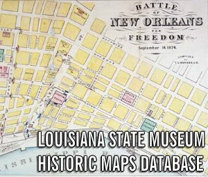
The Louisiana State Museum’s cartographic holdings, comprised of original works as well as photostat, photographic and facsimile reproductions, are dated 1525 to the present. Many of these works are housed in the special collections of Dr. and Mrs. E. Ralph Lupin, Helen and Solis Seiferth, Machrina Francois, Gladys Mossmeir, and Gaspar Cusachs. The museum’s collection contains maps related to the exploration and settlement of Louisiana during the colonial period as well as maps delineating Louisiana and her cities after the Louisiana Purchase, from 1803 to the present time.
Other works depict the Mississippi River and her delta, other Louisiana waterways, the Battle of New Orleans and the Civil War, the Gulf of Mexico, the circum-Caribbean region, as well as Canada and South America. Other North American cities and states, Europe, Asia, and Africa are also represented.
Many early cartographers such as Jean Baptiste B. d’Anville, members of the Bleau Family, Rigobert Bonne, Emanuel Bowen, Gaullaume de L’Isle, Nicolas de Fer, Thomas Jeffreys, Thomas Kitchen, Gerard van Keulen, Herman Moll, Sebastian Munster, Jean Baptiste Nolin, Abraham Ortelius, Henry Popple, Didier and Giles Robert de Vaugondy, Nicolas Sanson, John Senex, George Matthäus Seutter, John Speed, Nicolas Visscher, Martin Walsdeemuller and Frederick de Wit are represented in the collection.
Maps by John Arrowsmith, Henry Abraham Châtelain, Victor Collot, William Darby, Louis Hennepin, the Homann family, Tobias Conrad Lotter, John Melish, S. Augustus Mitchell, John Ogilby, Robert Sayer, Isaak Tirion and Antonio Zatta are also included in the collecton.
Maps published by T. G. Bradford, Mathew Carey, J. H. Colton, Covens & Mortier, George Cram, Anthony Finley, Laurie & Whittle and James Wyld are also housed in this collection.
Editorial Method
- All titles are rendered as printed on the map. Thus, title words may not correspond to modern methods of spelling and capitalization. Such words as "Missisipi," "shewing," and "copyed" were accepted spellings in previous centuries.
- Dimensions are rendered by height and width, in inches, using the outside neat line as the measurement. In those instances where no neat line is present, outside paper dimensions are delineated.
- Unless otherwise noted, the medium is that of a copperplate engraving, rotogravure, or lithograph. Manuscript and wood block maps are noted, as well as reproduction and facsimile works.
- Many of the maps included in this database are later editions or reproductions of original maps. In such instances, the date of the original rendering is noted in the "date" field as "historical." The date of subsequent publication (if known) is given in the "notes" field. For sorting purposes, circa maps dates are rendered with the "c." following the approximated date.
- Words surrounded by brackets ([ ]) are those inserted by the cataloger. Those words surrounded by brackets and followed by a question mark [ ?]) denote words which are a best guess by the cataloger. A bracketed insert with a question mark in the center ([ ? ]) represents an unintelligible word.
Note: At the Louisiana Purchase bicentennial in 2003, there were many requests for period maps outlining territory included in the treaty. Because the treaty was vague in defining Louisiana Purchase boundaries, no such contemporary maps were drawn.
In fact, several years passed before all the final boundaries of the Purchase were established. In 1810 a revolt in Spanish West Florida led to the annexation of the territory from the Mississippi to the Perdido River. The northern boundary of the United States was fixed at the 49th parrallel from the Lake of the Woods to the Rocky mountains in 1818, and, a year later, another treaty brought the remainder of Florida under the dominion of the United States.

